
Features PM Navi
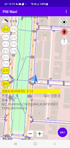
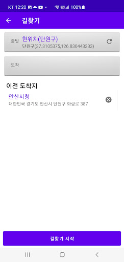
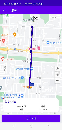
This program uses the SAFE PM terminals sensor values and location information (RTK GNSS) or GPS to display the PMs current location on the map and SAFE INFO according to the direction of travel.SAFE INFO is classified into warnings to PM riders about speeding, bus stops, entrances (entrances and exits), ramps (downhills), curves, intersections, narrow areas, and crosswalks, as well as information about one-way streets, parking, and pedestrian road violations.The PM searches the route to the destination using available roads and provides route guidance to the user.This program is only available in some areas of Ansan (test bad).
Gaming Features
Enjoy immersive gaming experience with various game modes.
Fitness Tracking
Track your workouts and monitor your health metrics.
Travel Features
Plan and manage your travels with ease.
See the PM Navi in Action
Get the App Today
Available for Android 8.0 and above